Arizona Wall Map-3rd Edition
Beschreibung:
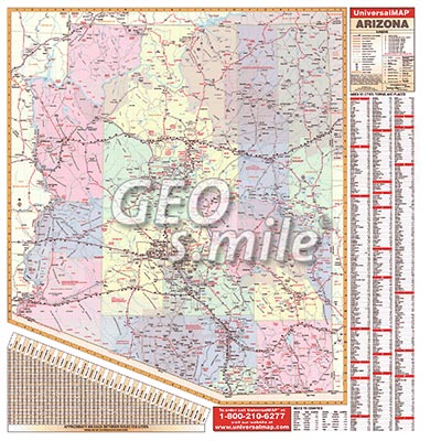
The Arizona Wall Map by Universal Map measures 56 by 60 inches, includes all state/federal highways, major waterways, towns, military installations, major airports, state universities, points of interest, cities, state parks, and wildlife areas.
Other features include color-coded counties, a mileage chart between major cities, up-to-date cartography, is printed in color with a markable/washable/laminated surface, is indexed on the face of the map, and contains hanging rails.
Unsere unschlagbare Preis-Politik:
Beste Qualität zum günstigsten Preis!
Bestellformular Download
Was ist eine Echtholzbestäbung?
Was ist ein Springroller?
Verfügbare Versionen:
Arizona Wall Map-3rd Edition - laminated, with rods
(Artikel-Nr.: 100002217)
(Artikel-Nr.: 100002217)
USD 219,00
